Airborne Sensors Market – Global Industry Size, Share, Trends, Opportunity, and Forecast, Segmented By Type (Non-Scanning, Scanning), By Application (Defense Aircraft, Commercial Aircraft, Others), By Region, Competition, 2019-2029
Published Date: March - 2025 | Publisher: MIR | No of Pages: 280 | Industry: Aerospace and Defense | Format: Report available in PDF / Excel Format
View Details Buy Now 2890 Download Sample Ask for Discount Request Customization| Forecast Period | 2025-2029 |
| Market Size (2023) | USD 9.2 billion |
| CAGR (2024-2029) | 6.90% |
| Fastest Growing Segment | Scanning |
| Largest Market | Asia-Pacific |
| Market Size (2029) | USD 13.62 billion |
Market Overview
Global Airborne Sensors Market reached USD 9.2 billion in 2023 and is expected to forecast strong growth in the forecast period with a CAGR of 6.90% until 2029.
One of the primary drivers of the airborne sensors market is the growing need for intelligence, surveillance, and reconnaissance (ISR) capabilities among defense and security organizations globally. As geopolitical tensions escalate and the requirement for greater situational awareness becomes increasingly important, there is a greater focus on the installation of advanced sensor suites on military aircraft to detect, track, and identify potential threats in real-time.

Free Download Sample Ask for Discount Request Customization
In addition, the commercial market is also fueling market growth, especially in areas like agriculture, forestry, infrastructure monitoring, and disaster management. Remote sensing technologies installed on aircraft and drones provide affordable solutions for activities like crop monitoring, forest fire detection, pipeline monitoring, and urban planning.
Technological innovations are yet another important driving force for the airborne sensors market. Developments in sensor miniaturization, integration, and signal processing technology have given rise to low-weight, small-footprint sensors with high-resolution capability and increased accuracy and efficiency. Furthermore, multi-sensor fusion technologies now provide the means for easy data fusion from multiple sensors, allowing better overall system performance and capabilities.
In addition, the expanding use of unmanned aerial vehicles (UAVs) or drones in both military and commercial applications is driving demand for specialized sensors specific to the unique demands of these platforms. Specialized sensors like electro-optical/infrared (EO/IR) cameras, synthetic aperture radar (SAR), LiDAR, and hyperspectral imagers are increasingly found on UAVs performing missions from surveillance and reconnaissance to mapping and environmental monitoring.
In conclusion, the Global Airborne Sensors Market is witnessing steady growth fueled by increasing applications in defense, commercial, and scientific industries, as well as sensor technologies and UAV proliferation. With demand for real-time data collection and analysis further increasing, the market is anticipated to see increased innovation and investment in sensor development and integration capabilities.
Market Drivers
Technological Advancements and Innovation
Technological advancements and ongoing innovation are fundamental drivers propelling the Global Airborne Sensors Market. The constant evolution of sensor technologies enhances the capabilities of airborne systems, allowing for more precise, efficient, and versatile data collection. Advancements span various sensor types, including radar systems, imaging devices, LiDAR (Light Detection and Ranging), and environmental sensors. In the realm of imaging technologies, for instance, sensors are continually improving in terms of resolution, sensitivity, and spectral coverage. High-resolution optical cameras, multispectral and hyperspectral sensors, and synthetic aperture radar (SAR) systems provide enhanced capabilities for applications such as surveillance, reconnaissance, and environmental monitoring. LiDAR technology has witnessed significant advancements, leading to lighter and more compact sensors with improved range and accuracy. These LiDAR sensors are crucial for creating detailed 3D terrain models, supporting applications like urban planning, forestry management, and infrastructure development. The integration of advanced technologies, such as artificial intelligence (AI) and machine learning (ML), further amplifies the capabilities of Airborne Sensors. Smart sensors equipped with AI algorithms enable real-time data analysis, automatic target recognition, and adaptive decision-making, contributing to improved overall system performance. Ongoing research and development efforts continue to push the boundaries of what Airborne Sensors can achieve, fostering a competitive landscape and driving the market forward.
Increasing Demand for Unmanned Aerial Vehicles (UAVs)
The growing demand for Unmanned Aerial Vehicles (UAVs), commonly known as drones, serves as a significant driver for the Global Airborne Sensors Market. UAVs equipped with a variety of sensors are employed across diverse applications, ranging from surveillance and reconnaissance to environmental monitoring and infrastructure inspection. Optical cameras, infrared sensors, LiDAR, and other specialized sensors integrated into UAVs provide a cost-effective and flexible solution for data acquisition. These platforms are particularly advantageous for applications that require accessibility to challenging or hazardous environments, covering large areas efficiently, and reducing operational costs compared to traditional manned aircraft. The versatility of UAVs makes them valuable across industries. In agriculture, for example, UAVs equipped with multispectral cameras contribute to precision agriculture practices by providing detailed insights into crop health, nutrient levels, and irrigation needs. In the field of environmental monitoring, UAVs equipped with sensors contribute to wildlife conservation, forest management, and disaster response. The rise of UAVs in sensor applications is driven by ongoing advancements in drone technology, including improvements in battery life, flight stability, and autonomous navigation. As regulatory frameworks evolve to accommodate UAV operations, the demand for Airborne Sensors integrated into these platforms is expected to continue growing.
Download Sample Ask for Discount Request Customization
Growing Need for Environmental Monitoring and Climate Research
The increasing awareness of environmental challenges and the need for accurate data drive the demand for Airborne Sensors in environmental monitoring and climate research. Airborne Sensors play a crucial role in gathering information related to atmospheric conditions, greenhouse gas emissions, and environmental changes. Remote sensing technologies, such as spectrometers and gas analyzers, are utilized to measure concentrations of gases in the atmosphere. These sensors contribute to climate research by providing data on greenhouse gas levels, air quality, and aerosol concentrations. They are also instrumental in monitoring environmental phenomena such as deforestation, land use changes, and natural disasters. Airborne Sensors support research initiatives aimed at understanding climate patterns, predicting weather events, and assessing the impact of human activities on the environment. The data collected by these sensors contribute to evidence-based decision-making for environmental conservation, resource management, and policy development. As the global focus on sustainability intensifies, the demand for Airborne Sensors for environmental monitoring is expected to grow. Governments, research institutions, and environmental organizations increasingly rely on these sensors to address pressing environmental issues and contribute to sustainable development goals.
Expanding Applications in Defense and Security
The defense and security sector is a key driver for the Global Airborne Sensors Market. Airborne Sensors play a crucial role in military applications, providing capabilities for surveillance, reconnaissance, intelligence gathering, and threat detection. The constant need for advanced sensor technologies to enhance situational awareness and address evolving security challenges drives innovation and investment in this sector. Radar systems, electro-optical and infrared cameras, and signals intelligence (SIGINT) sensors are integral components of airborne platforms used in defense applications. Radar systems, for instance, provide long-range detection and tracking capabilities, supporting early warning systems and target acquisition. Electro-optical and infrared sensors enable day and night vision capabilities, enhancing the effectiveness of surveillance and reconnaissance missions. These sensors are essential for identifying targets, monitoring borders, and conducting covert operations. In addition to traditional military aircraft, UAVs equipped with advanced sensors contribute to defense and security operations. UAVs provide a cost-effective and flexible solution for intelligence, surveillance, and reconnaissance (ISR) missions, enabling military forces to gather real-time information without exposing personnel to potential risks. The ongoing evolution of Airborne Sensors in the defense sector is driven by the need for cutting-edge technologies to maintain strategic advantages, respond to emerging threats, and adapt to modern warfare scenarios.
Advancements in Precision Agriculture
The agriculture sector is a significant driver for the Global Airborne Sensors Market, particularly in the context of precision agriculture. Airborne Sensors, including optical cameras, multispectral sensors, and LiDAR, contribute to precision agriculture practices by providing detailed insights into crop health, nutrient levels, and field conditions. Optical cameras and multispectral sensors enable farmers to monitor crops and identify variations in vegetation health. These sensors capture data beyond the visible spectrum, allowing for the detection of stress factors such as nutrient deficiencies, pest infestations, or diseases that may not be visible to the naked eye. This information enables farmers to make data-driven decisions related to irrigation, fertilization, and pest control, optimizing crop yields and resource utilization. LiDAR sensors play a crucial role in terrain mapping and topographic analysis. By creating high-resolution elevation models, LiDAR supports applications such as soil mapping, drainage planning, and precision planting. The adoption of Airborne Sensors in precision agriculture is driven by the ongoing need to increase agricultural efficiency, reduce environmental impact, and address the challenges of feeding a growing global population. As technology continues to advance.
Key Market Challenges
Download Sample Ask for Discount Request Customization
Technological Complexity and Integration Challenges
One of the primary challenges faced by the Global Airborne Sensors Market is the inherent complexity of the technologies involved and the subsequent integration challenges. Airborne Sensors encompass a wide range of technologies, including radar systems, imaging devices, LiDAR (Light Detection and Ranging), and specialized sensors for applications such as environmental monitoring and maritime surveillance. Integrating these diverse sensor technologies into airborne platforms, such as manned and unmanned aircraft, requires overcoming technical complexities. Different sensor types may operate on distinct wavelengths, have varying power requirements, and demand specific data processing capabilities. Achieving seamless integration involves addressing compatibility issues, optimizing power management systems, and ensuring the interoperability of various sensors. Additionally, as the demand for multi-sensor capabilities increases, the challenge of integrating sensors that operate in different spectrums and serve distinct purposes becomes more pronounced. For example, combining optical cameras with synthetic aperture radar (SAR) systems requires sophisticated synchronization and data fusion techniques to extract meaningful information from disparate sources. Overcoming technological complexity and ensuring effective integration are critical for maximizing the utility of Airborne Sensors across diverse applications and industries.
Cost Constraints and Budgetary Pressures
The Global Airborne Sensors Market faces persistent challenges related to cost constraints and budgetary pressures. The development, manufacturing, and deployment of cutting-edge airborne sensor technologies involves significant expenses, ranging from research and development to production and maintenance. This poses challenges for both manufacturers and end-users, particularly in government and defense sectors where budget constraints are common. Airborne sensor systems often require continual investment in research and development to stay at the forefront of technological advancements. The high costs associated with developing and upgrading sensor technologies can limit the accessibility of advanced capabilities for certain organizations or nations with limited financial resources. Additionally, the acquisition and maintenance costs of airborne sensor platforms, such as specialized aircraft or UAVs, contribute to the overall financial burden. Governments and defense agencies often grapple with the challenge of balancing the need for cutting-edge sensor capabilities with the realities of constrained budgets. Overcoming cost constraints requires innovative approaches to technology development, collaborative efforts to share research and development expenses, and the establishment of cost-effective manufacturing processes.
Regulatory and Legal Challenges
The Global Airborne Sensors Market is subject to a complex web of regulatory and legal challenges that impact their deployment and use. These challenges encompass issues related to airspace regulations, privacy concerns, and international agreements governing the use of certain sensor technologies. Airborne Sensors, especially those used in surveillance and reconnaissance applications, must adhere to strict regulations to ensure the safety and security of airspace. National aviation authorities set guidelines for the operation of UAVs and other airborne platforms equipped with sensors to prevent collisions and protect civilian airspace. Privacy concerns also pose challenges, particularly when Airborne Sensors are used for imaging or surveillance in populated areas. Striking a balance between the benefits of sensor technologies and the protection of individual privacy rights requires clear regulatory frameworks and ethical considerations. Moreover, international agreements and geopolitical considerations can influence the export and use of certain sensory technologies. Manufacturers and end-users must navigate a complex landscape of regulations to ensure compliance with national and international laws. Addressing regulatory and legal challenges requires collaboration between industry stakeholders, government agencies, and international bodies to establish clear guidelines and standards for the responsible use of airborne sensor technologies.
Cybersecurity Threats and Vulnerabilities
As airborne sensor technologies become more interconnected and reliant on data networks, the challenge of cybersecurity threats and vulnerabilities becomes increasingly significant. Airborne sensor platforms, including UAVs and manned aircraft, are vulnerable to cyber-attacks that can compromise data integrity, disrupt operations, and pose serious security risks. The interconnected nature of modern sensor systems, often linked to ground control stations and data processing centers, creates potential entry points for cyber threats. Hackers may target communication links, data transmission channels, or onboard systems, aiming to disrupt or manipulate the information collected by Airborne Sensors. In military applications, the potential for adversaries to exploit vulnerabilities in sensor systems for intelligence gathering or to compromise mission-critical operations adds an additional layer of complexity. Mitigating cybersecurity threats involves implementing robust encryption protocols, secure communication channels, and intrusion detection systems. Continuous monitoring and updates to cybersecurity measures are essential to stay ahead of evolving threats in the digital landscape.
Limited Endurance and Range for UAVs
Unmanned Aerial Vehicles (UAVs) have become integral platforms for Airborne Sensors, offering flexibility and accessibility for various applications. However, these UAVs face challenges related to limited endurance and range, affecting their sustained operational capabilities. The endurance of UAVs is constrained by factors such as battery life or fuel capacity, impacting the amount of time they can spend in the air collecting data. This limitation is particularly relevant for applications that require extended surveillance, monitoring large areas, or conducting lengthy research missions. The range of UAVs is another challenge, determining how far these platforms can travel from their launch points. Limited range can restrict the coverage area for applications such as border surveillance, maritime patrol, or environmental monitoring over expansive regions. Advancements in battery technology, the development of more efficient propulsion systems, and innovations in energy harvesting are areas of focus to address these challenges. Increasing the endurance and range of UAVs enhances their utility and expands the range of applications for Airborne Sensors.
Key Market Trends
Integration of Advanced Imaging Technologies
One significant trend in the Global Airborne Sensors Market is the integration of advanced imaging technologies, revolutionizing the way data is collected and analyzed from aerial platforms. High-resolution optical cameras, multispectral and hyperspectral sensors, and synthetic aperture radar (SAR) systems are among the cutting-edge imaging technologies deployed on airborne platforms. High-resolution optical cameras capture detailed visual information, enabling applications such as mapping, surveillance, and reconnaissance. Multispectral and hyperspectral sensors, on the other hand, provide a wealth of data beyond the visible spectrum. These sensors are instrumental in environmental monitoring, precision agriculture, and geological surveys, where the ability to analyze specific wavelengths of light offers insights not possible with traditional cameras. Synthetic Aperture Radar is another critical technology, especially for defense and earth observation applications. SAR systems on airborne platforms produce high-resolution images regardless of weather conditions and can penetrate Cloud cover, making them invaluable for monitoring landscapes, detecting changes, and conducting surveillance. The integration of these advanced imaging technologies enhances the capabilities of Airborne Sensors, enabling more accurate data collection, detailed analysis, and informed decision-making across various industries.
Rise of Unmanned Aerial Vehicles (UAVs) in Sensor Applications
The increasing use of Unmanned Aerial Vehicles (UAVs), commonly known as drones, has been a transformative trend in the Global Airborne Sensors Market. UAVs equipped with a diverse range of sensors serve a multitude of purposes, from surveillance and reconnaissance to environmental monitoring and infrastructure inspection. Optical and infrared cameras, LiDAR (Light Detection and Ranging) sensors, and thermal imaging sensors are commonly integrated into UAVs, providing a cost-effective and flexible solution for data acquisition. LiDAR is crucial for creating high-resolution elevation models used in terrain mapping, floodplain analysis, and forestry applications. The advantages of UAVs include their ability to access challenging or dangerous environments, cover large areas efficiently, and reduce operational costs compared to traditional manned aircraft. The versatility and accessibility of UAVs make them a preferred choice for various applications, driving the growth of airborne sensor integration into these platforms.
Increased Demand for Environmental Monitoring and Climate Research
Environmental monitoring and climate research have become focal points in the Global Airborne Sensors Market, driven by the growing awareness of climate change and the need for accurate and timely data. Airborne Sensors play a crucial role in gathering information related to atmospheric conditions, greenhouse gas emissions, and environmental changes. Remote sensing technologies, such as spectrometers and gas analyzers, are employed for measuring concentrations of gases in the atmosphere. These sensors contribute to climate research by providing data on greenhouse gas levels, air quality, and aerosol concentrations. They are also used to monitor environmental phenomena such as deforestation, land use changes, and natural disasters. The integration of sensors in aircraft for environmental monitoring aligns with global efforts to understand and mitigate the impacts of climate change. Governments, research institutions, and environmental organizations increasingly rely on Airborne Sensors to collect comprehensive and accurate data, supporting evidence-based decision-making in climate science and policy.
Advancements in Hyperspectral Imaging for Precision Agriculture
Precision agriculture has emerged as a significant application for Airborne Sensors, particularly hyperspectral imaging. Hyperspectral sensors capture a wide range of wavelengths across the electromagnetic spectrum, allowing for detailed analysis of crops, soil, and vegetation health. In precision agriculture, Airborne Sensors equipped with hyperspectral cameras can detect subtle variations in plant health, nutrient levels, and water content. This information enables farmers to make precise decisions related to irrigation, fertilization, and crop management, optimizing yields and reducing resource usage. The adoption of hyperspectral imaging in agriculture aligns with the ongoing trend toward sustainable farming practices and resource efficiency. By providing farmers with detailed insights into the health and condition of their crops, Airborne Sensors contribute to the evolution of agriculture toward more data-driven and environmentally conscious practices.
Growing Emphasis on Maritime Surveillance and Security
Airborne Sensors are increasingly being employed for maritime surveillance and security applications, reflecting the critical need for monitoring coastal and maritime environments. These applications range from anti-piracy efforts and illegal fishing detection to search and rescue operations. Maritime patrol aircraft equipped with a suite of sensors, including radar, electro-optical cameras, and AIS (Automatic Identification System) receivers, play a pivotal role in monitoring and securing vast maritime domains. Radar systems provide the ability to detect and track vessels, even in challenging weather conditions, while electro-optical cameras enhance visual identification capabilities. The integration of AIS receivers enables the identification of vessels broadcasting their positions, contributing to maritime domain awareness. Additionally, Airborne Sensors are essential for monitoring marine pollution, enforcing maritime regulations, and responding to emergencies at sea.
Segmental Insights
Type Analysis
Non-scanning aerial sensors refer to a category of technologies developed with the goal of gathering data in the absence of mechanical movement. These sensors stand out by how they capture data in an expanded field of vision in a solitary snapshot. Electro-optical sensors are among the most recognizable; they take images using electro-optical systems to gather visible data. These sensors are also widely utilized in aerial photography, surveillance, and reconnaissance missions to offer high-resolution images used for the purpose of gathering intelligence, mapping, and environment monitoring. Moreover, non-scanning sensors encompass multispectral sensors and hyperspectral sensors that can record data over multiple wavelengths to allow detailed examination of terrain, plant life, and environmental status. Their uses cut across fields such as agriculture, forestry, urban planning, and disaster management, serving to improve decision-making processes.
Conversely, scanning airborne sensors utilize mechanical scanning mechanisms to gather data with accuracy and precision. Such sensors are defined by their capacity to sweep or scan the environment systematically, offering thorough and detailed coverage of the target area. One of the most common scanning sensors is the synthetic aperture radar (SAR), which uses radar waves to produce high-resolution images of the Earth's surface without regard to weather or daylight. SAR sensors play a key role in terrain mapping, geological surveying, and maritime surveillance, providing unmatched imaging capabilities for civilian and military use. Moreover, LiDAR sensors are another significant feature of scanning technology, based on laser pulse range to measure the distance and creating very high resolution 3D maps of landscape, structures, and foliage. LiDAR technology has far-reaching applications in topographic surveying, city planning, infrastructural construction, and Concrete-Market' target='_blank'>self-driven navigation systems.
Regional Insights
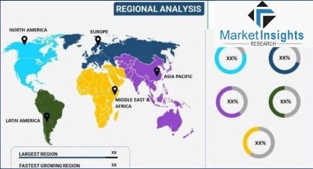
North America has a major portion in the worldwide airborne sensors market due to its strong defense industry and high investments in aerospace and defense technologies. North America is also home to some of the industry's major players, which makes it at the forefront of innovation and technology. North America also experiences huge demand for airborne sensors in surveillance, reconnaissance, and intelligence gathering applications.
Europe & CIS regions are also significant in the airborne sensors market by utilizing sophisticated technology capabilities and a robust aerospace sector. Defense sectors in countries such as France, Germany, and Russia are well-developed, adding to the demand for airborne sensors for defense purposes. In addition, growing emphasis on environmental monitoring and agricultural surveys also increases adoption of airborne sensors in the region.
Asia-Pacific is also a potential market for airborne sensors due to quick industrialization, economic development, and rising defense spending. China, India, Japan, and South Korea are all heavily spending on defense upgradation, propelling demand for sophisticated airborne sensor systems. The increased commercial aviation segment in the region and rising concerns about pollution also boost the use of airborne sensors for pollution monitoring and disaster management.
Middle East & Africa has a rising need for airborne sensors, which is largely fueled by defense modernization programs and geopolitical tensions. Nations such as Saudi Arabia, Israel, and the UAE are making heavy investments in defense technologies, which results in the acquisition of airborne sensor systems for surveillance and reconnaissance missions. In addition, the growing infrastructure and natural resource exploration in the region drive the adoption of airborne sensors for a range of uses.
South America is an emerging market for airborne sensors, fueled by increasing defense expenditures and requirements for border monitoring and maritime security. Brazil and Chile are spending on defense capabilities, including airborne sensor platforms, to improve their national security position. In addition, the region's emphasis on environmental protection and resource management offers opportunities for airborne sensor use in forestry monitoring and agricultural surveys.
Recent Developments
- In August 2022, the US Navy granted Lockheed Martin a contract to advance the F-35 Joint Strike Fighter program for the United Kingdom, Canada, and Australia. The contract focuses on enhancing the data center of the F-35s to facilitate the development of mission data files compiled from the extensive array of sensors and systems onboard the aircraft. This agreement is poised to bolster Lockheed's reputation in the military sector and attract international interest in its cutting-edge product range.
- In September 2023, Thales UK announced its initiative to independently finance the research and development of an electro-optical/infrared airborne mine countermeasures (MCM) sensor payload, tailored for utilization on light helicopters and unmanned air vehicles (UAVs).
Key Market Players
- HEXAGON AB
- Thales Group
- RTX Corporation
- Lockheed Martin Corporation
- Information Systems Laboratories (ISL)
- Teledyne Optech
- General Dynamics Corporation
- Honeywell International Inc
- ITT INC
- AVT Airborne Sensing GmbH
|
By Type |
By Application |
By Region |
|
|
|
Related Reports
FAQ'S
For a single, multi and corporate client license, the report will be available in PDF format. Sample report would be given you in excel format. For more questions please contact:
Within 24 to 48 hrs.
You can contact Sales team (sales@marketinsightsresearch.com) and they will direct you on email
You can order a report by selecting payment methods, which is bank wire or online payment through any Debit/Credit card, Razor pay or PayPal.
Discounts are available.
Hard Copy