Marine Navigation System Market – Global Industry Size, Share, Trends, Opportunity, and Forecast, Segmented By Type (Marine Radar, Fish Finders, AIS (Automatic Identification System), VHF Transceiver, Chart-plotters, Others) By Application (Ship, Remotely Operated Underwater Vehicle, Autonomous Underwater Vehicle, Others), By End User (Defense, Commercial) By Region & Competition, 2019-2029F
Published Date: March - 2025 | Publisher: MIR | No of Pages: 280 | Industry: Aerospace and Defense | Format: Report available in PDF / Excel Format
View Details Buy Now 2890 Download Sample Ask for Discount Request Customization| Forecast Period | 2025-2029 |
| Market Size (2023) | USD 12.68 Billion |
| CAGR (2024-2029) | 6.18% |
| Fastest Growing Segment | Autonomous Underwater Vehicle |
| Largest Market | North America |
| Market Size (2029) | USD 18.11 Billion |
Market Overview
Global Marine Navigation System Market in 2023 stood at USD 12.68 billion and is expected to portray strong growth in the forecast period with a CAGR of 6.18% over the period 2023-2029.
Sagar Sampark, an Indian Differential Global Navigation Satellite System (DGNSS), was launched by Union Minister of Ports, Shipping, and Waterways, Sarbananda Sonowal, in 2023 for promoting digitalization in the shipping industry. The system corrects the errors in current Global Navigation Satellite Systems (GNSS), delivering more accurate positioning information. The navigation technology made in India provides ships with precise information for secure navigation, avoiding hazards like collision and grounding at ports and harbors. This project increases vessel movement efficiency through enhanced positioning accuracy to 5 meters using several satellite constellations such as GPS and GLONASS.

Download Sample Ask for Discount Request Customization
Market Drivers
Technological Advancements in Marine Navigation Systems
Technological advancements play a pivotal role in driving the global marine navigation system market. Over the years, there has been a substantial evolution in the technology used for navigation and communication systems in the maritime industry. These advancements have transformed the way ships and vessels navigate the seas, enhancing safety, efficiency, and accuracy. Global Positioning System (GPS) technology has been a game-changer in marine navigation. GPS enables vessels to determine their exact location, speed, and course with high precision. Additionally, the integration of Geographic Information Systems (GIS) and Electronic Chart Display and Information Systems (ECDIS) has further improved navigation accuracy. ECDIS, in particular, allows for real-time electronic chart updates, reducing the risk of human error and enhancing situational awareness. AIS (Automatic Identification System) is another technology that has gained prominence. AIS enables vessels to exchange real-time data, such as vessel identification, position, course, and speed. This technology aids in collision avoidance and improves overall safety at sea. The integration of satellite communication systems, advanced radar systems, and sonar technology has also enhanced navigation capabilities. These systems enable vessels to communicate effectively and navigate in challenging conditions, such as adverse weather or low-visibility situations. The ongoing development of autonomous and remotely operated vessels is another exciting technological trend. These vessels leverage advanced sensors, machine learning algorithms, and AI to navigate autonomously, reducing the need for onboard crew members. While this technology is still in its early stages, it has the potential to transform the maritime industry in the coming years. Overall, technological advancements continue to be a major driver of the marine navigation system market, as they offer enhanced safety, efficiency, and operational capabilities for ships and vessels. For instance, i
Increasing Seaborne Trade
Seaborne trade is a significant driver of the global marine navigation system market. The movement of goods and commodities by sea is a fundamental component of the global economy, and it has been steadily increasing over the years. The growth of international trade, driven by globalization and increased demand for goods, has a direct impact on the demand for marine navigation systems. As international trade expands, new trade routes and shipping lanes are being established to accommodate growing cargo volumes. These new routes necessitate the use of advanced navigation systems to ensure safe and efficient passage. To meet the demands of increasing cargo capacity, larger vessels, such as container ships and bulk carriers, are being built. These vessels require more advanced navigation systems to navigate safely and efficiently, especially in congested ports and narrow waterways. Modern ports are equipped with advanced navigation aids and technologies to facilitate the efficient loading and unloading of cargo. These ports require vessels to be equipped with compatible navigation systems for seamless operations. Stringent environmental regulations and emissions standards have prompted the adoption of fuel-efficient routes and technologies. Advanced navigation systems can help vessels optimize their routes to reduce fuel consumption and minimize environmental impact. The growth of seaborne trade not only drives the demand for marine navigation systems but also necessitates continuous advancements in navigation technology to meet the evolving needs of the industry. This growth is expected to continue, making seaborne trade a critical driver of the marine navigation system market.
Download Sample Ask for Discount Request Customization
Maritime Safety Regulations and Compliance
Safety regulations in the maritime industry play a pivotal role in driving the global marine navigation system market. Governments and international bodies have established stringent safety regulations to ensure the well-being of seafarers, the protection of the marine environment, and the safe operation of vessels. SOLAS is an international treaty that sets minimum safety standards for the construction, equipment, and operation of ships. Compliance with SOLAS regulations requires vessels to be equipped with advanced navigation and communication systems, including ECDIS and AIS. COLREGs establish rules to prevent collisions at sea. These regulations emphasize the importance of proper navigation equipment, lights, and signaling to avoid accidents and ensure safe navigation. GMDSS is an internationally recognized system for ensuring safety and security at sea. It requires vessels to have reliable communication and distress alerting systems, including satellite communication and radio equipment. In addition to safety regulations, environmental regulations impose restrictions on vessel emissions, including the use of cleaner fuels and more efficient routes. Advanced navigation systems can help vessels comply with these regulations by optimizing their navigation strategies. The enforcement of these regulations, along with the need for vessels to obtain various certifications and endorsements, drives the adoption of advanced marine navigation systems. Shipowners and operators invest in compliant navigation systems to ensure they meet the regulatory requirements and maintain their vessel's seaworthiness.
Environmental Concerns and Sustainability
Environmental concerns and sustainability have become increasingly important drivers of the global marine navigation system market. The maritime industry has come under scrutiny for its impact on the environment, particularly in terms of air and water pollution, greenhouse gas emissions, and the potential for oil spills and other accidents. Reducing fuel consumption and emissions is a major focus for the maritime industry. Advanced navigation systems can help vessels optimize their routes, adjust speeds, and make decisions that result in reduced fuel consumption and emissions. Many regions have established ECAs with stricter emission standards. Ships sailing in these areas must comply with specific requirements, such as the use of cleaner fuels and the adoption of emission-reduction technologies, which often require advanced navigation systems for compliance. The discharge of ballast water from ships has been a source of invasive species transfer. Advanced navigation systems help vessels manage ballast water effectively to reduce the risk of environmental harm. Environmental concerns include the prevention of accidents that can result in oil spills or other forms of pollution. Advanced navigation systems, including collision avoidance technologies and real-time monitoring, play a crucial role in accident prevention. Reducing the distance vessels travel and selecting routes with favorable currents and weather conditions are essential for minimizing fuel consumption and emissions. Navigation systems equipped with weather routing and optimization algorithms aid in this effort. The increasing emphasis on environmental responsibility and sustainability within the maritime industry drives the adoption of advanced navigation systems, as they enable vessels to operate in an environmentally conscious manner and reduce their impact on the planet.
Key Market Challenges
Technological Obsolescence and Integration
One of the primary challenges in the global marine navigation system market is the rapid pace of technological advancement, which often leads to the obsolescence of existing systems. Marine navigation systems need to keep up with evolving technologies to remain relevant and effective. However, the process of integrating new technologies into existing vessels and navigation systems can be complex and costly. Maritime navigation technology is advancing at an accelerated pace. Newer systems, such as Electronic Chart Display and Information Systems (ECDIS), Automatic Identification Systems (AIS), and advanced radar and sonar technologies, continue to emerge. This presents a challenge for shipowners and operators who must decide when and how to upgrade their existing systems. Retrofitting or upgrading navigation systems can be a challenging task, as it often requires significant investment and downtime. Ensuring the compatibility and seamless integration of new technologies with the existing vessel infrastructure is critical to avoid operational disruptions and inefficiencies. The introduction of new navigation technologies necessitates training and familiarization for onboard personnel. Crew members must be proficient in using and troubleshooting advanced systems, which can lead to a learning curve and potential operational challenges during the transition. Implementing new technologies and upgrading existing systems can be cost-intensive. Shipowners and operators need to balance the benefits of improved navigation capabilities with the costs involved in technology adoption. Many vessels still rely on older, legacy navigation systems that are less adaptable to newer technologies. Integrating these older systems with modern navigation solutions can be a significant challenge.
Download Sample Ask for Discount Request Customization
Cybersecurity Threats
The increasing reliance on digital and interconnected technologies in the maritime industry has given rise to a significant challenge – cybersecurity threats. As marine navigation systems become more connected and data-driven, they become susceptible to cyberattacks, which can compromise vessel safety and operational integrity. Modern marine navigation systems are increasingly interconnected, relying on networks and communication technologies. These connections can introduce vulnerabilities that cybercriminals may exploit to disrupt navigation, steal sensitive data, or even take control of a vessel. Navigation systems process and store sensitive data, including vessel routes, cargo information, and crew details. A data breach can have severe consequences, including financial losses and reputational damage. A cyberattack on navigation systems can compromise the safety of a vessel and its crew. Unauthorized access or tampering with navigation data can lead to accidents, collisions, or grounding incidents. Recognizing the growing threat of cyberattacks, regulatory bodies are introducing cybersecurity regulations and guidelines for the maritime industry. Ensuring compliance with these regulations is a complex and ongoing challenge for vessel operators. Maintaining the cybersecurity of navigation systems requires continuous monitoring and timely software updates. Vessel operators must invest in cybersecurity measures and stay updated on emerging threats and security best practices.
Environmental Sustainability
Environmental sustainability is a paramount challenge in the global marine navigation system market. The maritime industry faces increasing pressure to reduce its environmental impact, including emissions and pollution. Navigation systems need to be aligned with these sustainability goals, which can be challenging. To meet global emission reduction targets, the maritime industry is transitioning toward cleaner fuels and more energy-efficient vessels. Navigation systems play a crucial role in optimizing routes, reducing fuel consumption, and ensuring compliance with emission regulations. The management of ballast water to prevent the spread of invasive species is a growing concern. Advanced navigation systems are needed to help vessels safely discharge and manage ballast water in compliance with regulations. Navigation systems must also contribute to preventing ocean pollution, which includes avoiding oil spills and managing waste disposal. Advanced technologies that enhance collision avoidance and safety measures are essential for mitigating environmental risks. Ship owners and operators are increasingly required to provide sustainability and environmental performance reports. Navigation systems should be capable of collecting and transmitting relevant data to support such reporting requirements. Vessel owners are installing exhaust gas cleaning systems, or scrubbers, to reduce emissions. These systems may require integration with navigation and monitoring systems to ensure optimal performance.
Regulatory Complexities
The maritime industry is subject to a complex web of international, national, and regional regulations and standards. Navigating this regulatory landscape is a significant challenge for the global marine navigation system market, as compliance is vital to ensure the legality and safety of maritime operations. International conventions and agreements, such as the International Maritime Organization's (IMO) SOLAS and MARPOL regulations, set standards for maritime safety and environmental protection. Compliance with these regulations is a fundamental requirement. Different regions may have their own specific regulations and requirements, including emission control areas (ECAs) with stricter emission standards. Vessel operators must navigate these regional variations to ensure full compliance. Compliance often involves extensive reporting and documentation, such as voyage data recording and documentation of safety procedures. Navigation systems need to support the collection and management of this data. With an increased focus on reducing emissions, the monitoring and reporting of emissions from vessels are becoming more rigorous. Navigation systems must provide accurate data for compliance with emission reduction targets. Regulatory frameworks are constantly evolving to address emerging challenges, such as cybersecurity and environmental concerns. Staying up-to-date with evolving regulations and ensuring navigation system compliance is a complex and ongoing task.
Economic Uncertainties and Market Volatility
Economic uncertainties and market volatility pose challenges to the global marine navigation system market. The maritime industry is closely tied to global economic conditions, which can influence investment decisions, vessel orders, and the demand for navigation systems. The maritime industry is sensitive to economic cycles, with periods of economic growth and recession impacting shipping demand, fleet expansion, and investment in new vessels and navigation systems. The volume of global trade, influenced by geopolitical factors and economic conditions, directly affects shipping demand. Economic uncertainties and trade tensions can disrupt trade routes and affect the maritime sector's profitability. Economic downturns can lead to financial constraints for shipowners and operators, affecting their ability to invest in new navigation systems or retrofit existing vessels with advanced technology. The maritime industry is capital-intensive, with significant upfront costs for vessel construction and navigation system upgrades. Economic uncertainties can delay or deter investment in new technologies. In periods of economic downturn, the maritime industry may experience increased competition as companies vie for a smaller pool of business. This can lead to price pressures and reduced profit margins, affecting the willingness to invest in advanced navigation systems.
Key Market Trends
Adoption of Smart Navigation Solutions
One prominent trend in the global marine navigation system market is the adoption of smart navigation solutions. These solutions are designed to enhance navigation efficiency, safety, and operational capabilities through the integration of advanced technologies, data analytics, and connectivity. Smart navigation solutions are becoming increasingly popular in the maritime industry for several reasonsSmart navigation systems provide real-time access to a wealth of data, including weather information, traffic data, and route optimization options. Vessel operators can make informed decisions to improve safety and efficiency. The Internet of Things (IoT) has made it possible to connect various onboard sensors and equipment, enabling the collection of data on vessel performance, equipment health, and environmental conditions. Smart navigation systems offer automation features such as dynamic positioning, automated route planning, and collision avoidance, reducing the workload on onboard personnel and enhancing decision-making. Modern vessels are equipped with reliable satellite communication systems that support seamless connectivity, allowing for remote monitoring and decision support from onshore offices. Smart navigation solutions focus on improving the user experience for onboard personnel. User-friendly interfaces and integrated information display systems enhance situational awareness and ease of operation. Smart navigation systems can predict equipment failures and maintenance needs based on data from sensors, reducing unplanned downtime and maintenance costs. This trend toward smart navigation solutions aligns with the broader industry movement toward digitalization and automation, as shipping companies seek to leverage technology to improve their operational performance, safety, and competitiveness.
Rise of Autonomous Shipping
The emergence of autonomous shipping is a transformative trend in the global marine navigation system market. Autonomous vessels are vessels that can operate with minimal or no human intervention, relying on advanced navigation systems, artificial intelligence (AI), and sensors to navigate and make decisions. This trend is driven by several factorsAutonomous systems offer the potential to enhance safety by reducing the risk of human error, fatigue, and distraction. They can operate in challenging conditions with a high degree of reliability. Autonomous vessels can optimize routes, speeds, and fuel consumption, leading to improved operational efficiency and cost savings. Reducing or eliminating the need for onboard crew members can result in significant cost savings for ship owners, including lower labor costs and reduced crew accommodation requirements. Autonomous systems can optimize routes and operations to minimize fuel consumption and emissions, aligning with environmental sustainability goals. The autonomous shipping trend encompasses a range of vessels, from large cargo ships to small, unmanned surface vessels, making it versatile and scalable across the maritime industry. The development and implementation of autonomous navigation systems are ongoing, with numerous stakeholders, including technology companies, shipping companies, and regulatory bodies, working together to address technical, legal, and safety challenges. While autonomous shipping is still in its early stages, it has the potential to revolutionize the maritime industry in the coming years.
Emphasis on Data-Driven Decision-Making
The maritime industry is experiencing a shift toward data-driven decision-making, and this trend is having a significant impact on the marine navigation system market. Vessel operators are increasingly recognizing the value of data analytics and real-time information for improving navigation, safety, and efficiency. Several factors are driving this trendVessels are equipped with sensors that provide real-time data on various aspects of their operations, such as engine performance, fuel consumption, and weather conditions. This data is valuable for monitoring and decision-making. Data analytics tools are used to predict equipment failures, optimize maintenance schedules, and anticipate navigational challenges, enabling proactive decision-making. Advanced navigation systems leverage historical and real-time data to recommend optimal routes, accounting for factors like weather, traffic, and fuel efficiency. Data-driven approaches are used to assess the environmental impact of vessel operations, helping operators comply with emissions standards and reduce their carbon footprint. Vessel operators are increasingly integrating navigation data with data from other ship systems, allowing for a holistic view of vessel performance and decision-making. This trend aligns with the broader movement toward digitalization and Industry 4.0 in the maritime sector, with data-driven insights playing a central role in improving efficiency, reducing costs, and enhancing safety.
Growth of the E-Navigation Concept
E-navigation is an evolving concept in the global marine navigation system market, focusing on the integration of various digital technologies to enhance navigation and communication in the maritime industry. E-navigation seeks to streamline and modernize the exchange of navigational information, improve situational awareness, and reduce the workload on onboard personnel. Key components of the e-navigation concept includeECDIS systems are central to e-navigation, as they enable electronic chart display and real-time updates, reducing the reliance on paper charts and improving navigational accuracy. E-navigation emphasizes improved data sharing and communication between vessels, shore-based stations, and relevant authorities. This promotes situational awareness and collaborative decision-making. E-navigation systems provide tools for route planning and optimization, taking into account environmental conditions, traffic, and vessel-specific parameters. Automation and digitalization of reporting and documentation processes simplify regulatory compliance and reduce administrative burdens. The e-navigation concept promotes the interoperability of different systems and data sources, ensuring that information can be easily shared and utilized across the maritime ecosystem. As e-navigation relies on digital technologies and data exchange, it emphasizes the need for robust cybersecurity measures to protect data integrity and privacy. The adoption of e-navigation is driven by the desire to streamline operations, enhance safety, and reduce administrative burdens. As regulatory bodies and the maritime industry continue to work together on e-navigation initiatives, it is likely to become an integral part of modern maritime navigation.
Segmental Insights
Type Analysis
The Global Marine Navigation System market is segmented into various product categories, including Marine Radar, Fish Finders, AIS (Automatic Identification System), VHF Transceivers, Chart-plotters, and others. Marine Radar systems is a significant segment ensuring the safety of maritime navigation by detecting and tracking objects, ships, and weather formations in the surrounding waters. They provide vital information to mariners for collision avoidance and route planning. Fish Finders, widely used in the fishing industry, employ sonar technology to detect fish and underwater objects, significantly enhancing fishing efficiency and productivity. The Automatic Identification System (AIS) is a pivotal tool for vessel tracking and maritime safety, enabling ships to exchange real-time information on their position, speed, and course with other ships and shore stations, thus improving situational awareness and preventing collisions.
VHF Transceivers are essential for communication in maritime operations, facilitating short-range voice communications between vessels and coastal stations. They are particularly valuable in distress situations, allowing for rapid response and coordination of rescue efforts. Chart-plotters are integrated systems that combine electronic navigation charts with GPS data, providing mariners with real-time positioning and route planning capabilities. These systems offer comprehensive and precise navigational information, enhancing the safety and efficiency of marine operations. Other segments within the marine navigation market include electronic compasses, autopilot systems, and depth sounders, which collectively contribute to the accuracy and reliability of navigation.
The diverse range of marine navigation systems caters to various needs within the maritime industry, from commercial shipping and fishing to recreational boating and defense applications. Each segment addresses specific operational requirements, leveraging advanced technologies to enhance navigational safety and efficiency. For instance, marine radar systems are indispensable for large commercial vessels navigating busy shipping lanes, while fish finders are crucial for the fishing industry. AIS technology is vital for vessel traffic management and safety, and VHF transceivers are essential for communication across all maritime sectors. Chart-plotters provide detailed and accurate navigation information, supporting both professional and recreational mariners in safe and efficient route planning.
The Global Marine Navigation System market encompasses a wide array of products, each designed to meet distinct navigational needs across different maritime sectors. The integration of advanced technologies within these systems continues to drive improvements in safety, efficiency, and reliability, underpinning the growth and development of the maritime industry as a whole.
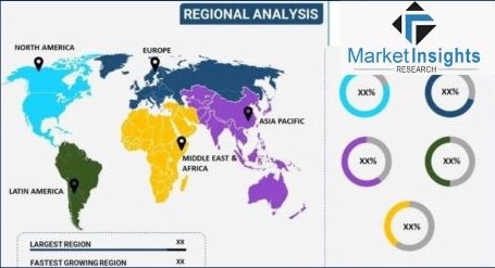
Regional Insights
The Global Marine Navigation System market is segmented by region, encompassing North America, Europe & CIS, Asia-Pacific, South America, and the Middle East & Africa. Each of these regions exhibits unique characteristics and demands within the marine navigation landscape, driven by varying maritime activities, regulatory environments, and technological adoption rates.
North America is the dominating market, the marine navigation system market is influenced by extensive commercial shipping, recreational boating, and defense operations. The region's advanced technological infrastructure supports the integration of sophisticated navigation systems, which enhance the safety and efficiency of maritime operations. North America's well-developed regulatory framework mandates the adoption of various navigation technologies, ensuring compliance and promoting the widespread use of advanced systems across commercial and recreational vessels alike.
Europe & CIS boasts a rich maritime heritage and extensive coastlines, which underpin its vibrant marine navigation market. The region's diverse maritime activities, ranging from commercial shipping and fishing to recreational boating, drive the demand for reliable and accurate navigation systems. European regulatory bodies enforce stringent safety standards, encouraging the adoption of advanced navigation technologies. The presence of numerous maritime training institutions in Europe also fosters the development of skilled personnel capable of operating and maintaining sophisticated navigation systems.
Asia-Pacific, with its vast maritime boundaries and bustling trade routes, presents a dynamic market for marine navigation systems. The region's rapidly growing economies and expanding maritime trade necessitate the deployment of advanced navigation systems to ensure safe and efficient operations. Governments in Asia-Pacific countries are increasingly investing in maritime infrastructure and technology, further boosting the market. The region's diverse maritime activities, including commercial shipping, fishing, and offshore energy exploration, create a broad spectrum of demand for various navigation systems.
South America's marine navigation market is shaped by its extensive coastline and significant maritime activities, such as commercial shipping, fishing, and oil exploration. The region's growing focus on enhancing maritime safety and efficiency drives the adoption of advanced navigation systems. Investments in port infrastructure and maritime technology are contributing to the market's growth. Additionally, South America's rich marine biodiversity and fishing industry necessitate the use of reliable navigation systems to support sustainable fishing practices and ensure the safety of fishing vessels.
The Middle East & Africa region, with its strategic maritime routes and significant oil and gas reserves, has a vital interest in advanced marine navigation systems. The region's maritime activities, including commercial shipping, oil exploration, and fishing, require precise and reliable navigation technologies. Investments in maritime infrastructure and technology, coupled with regulatory efforts to enhance maritime safety, are fostering the adoption of advanced navigation systems. The region's diverse maritime landscape, spanning from busy commercial ports to remote fishing grounds, underscores the importance of efficient and accurate navigation systems.
The Global Marine Navigation System market is characterized by regional diversity, with each area exhibiting distinct demands and growth drivers. The continued investment in maritime infrastructure and technology, along with regulatory efforts to enhance safety, underpin the market's development across these varied regions.
Recent Developments
- In May 2023, A quantum sensor designed for a prospective navigation system underwent testing aboard a Royal Navy vessel. Many contemporary navigation systems rely on Global Navigation Satellite Systems (GNSS), including GPS, which use signals from satellites orbiting the Earth.
- In January 2023, Teledyne has finalized the acquisition of ChartWorld International, a leading provider of digital navigational charts and associated services. ChartWorld is widely relied upon by global ship owners, managers, and mariners to improve safety, efficiency, and regulatory adherence. Teledyne’s maritime systems division, known for its extensive range of maritime products serving both commercial and defense sectors, will incorporate ChartWorld’s technology and skilled team into its operations.
- In 2024, Kongsberg Discovery launched Seapath 385. This advanced system blends new hardware and cutting-edge navigation algorithms to achieve superior precision in hydrographic surveying. Seapath 385 integrates inertial technology and advanced processing algorithms with multi-frequency satellite signals from GPS, Galileo, GLONASS, QZSS, Beidou, and geostationary satellites. The system effectively combines raw data from Kongsberg Discovery’s high-performance MGC (Motion Gyro Compass) or MRU (Motion Reference Unit) inertial sensors with GNSS data, and real-time kinematic (RTK), precise point positioning (PPP), or differential GNSS (DGNSS) corrections to enhance accuracy and reliability in navigation applications.
Key Market Players
- Inmarsat Global Limited
- Nort
Related Reports
FAQ'S
For a single, multi and corporate client license, the report will be available in PDF format. Sample report would be given you in excel format. For more questions please contact:
Within 24 to 48 hrs.
You can contact Sales team (sales@marketinsightsresearch.com) and they will direct you on email
You can order a report by selecting payment methods, which is bank wire or online payment through any Debit/Credit card, Razor pay or PayPal.
Discounts are available.
Hard Copy